

Let me assure you that I’m well aware of the fact that the Earth is not flat, and that we are living on a vast sphere. This isn’t news. People have known this for a couple thousand years at least, despite widely publicized beliefs that our ancestors were unaware of this.
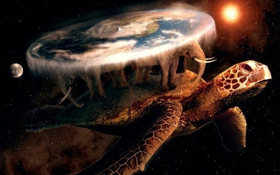
However, I’ll confess that I’m fascinated by the idea of a flat world. And, of course, in the SF field, it’s possible to postulate a sufficiently advanced technology that could construct such a massive thing (though probably not with giant space turtles and elephants, a la Terry Pratchett’s Discworld). One could argue, for example, that Larry Niven’s Ringworld, a true space megastructure, is an extreme example of a “flat” world. Albeit, curved to form a ring around a star at a habitable orbital distance.
As an author, I also can’t help but think that a scientifically accurate flat world could be an interesting setting for some stories.
In this project, which I expect to develop over the course of several blog posts, I’m going to do just that. I’m going to create a scientifically plausible flat world. I expect that there will be a small amount of that mysterious element known as handwavium, where I’ll have to assume as prerequisites some technologies that don’t exist yet.
Before we can get to the worldbuilding necessary to generate our own flat world setting, it’s first worthwhile to examine the most commonly promulgated Flat Earth conception. By identifying the major deficiencies of that model, we’ll essentially end up compiling a list of the issues that must be addressed for a scientifically plausible world.
Flat Earth Concept
So, what would does the commonly accepted concept of a flat Earth look like?
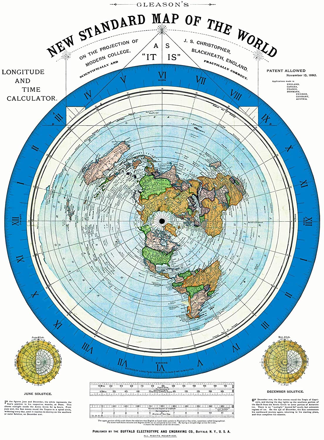
In 1892, a machinist and civil engineer named Alexander Gleason published his “New Standard Map of the World,” which purported to show the true (and flat) shape of the world. His map has been used by flat Earth proponents ever since.
In actuality, the map is simply a projection of the actual, spherical shape of the Earth onto a two-dimensional surface. It’s what’s known as an azimuthal equidistant map centered on the North Pole, or, more simply, a polar projection. Like all such projections, it includes inherent distortions. With this projection, the further the distance from the North Pole, the greater the distortion.
For example, besides the obvious fact that the map shows Antarctica as a ring around everything else, you’ll note that the east coast of South America and the west coast of Africa don’t match up. In reality, it was the obvious similarity between the two coasts that first led Alfred Wegener in 1912 to formally postulate his theory of continental drift (though there were some precursors and contemporaries who also promoted the idea), i.e. – that the two continents had once been part of a larger continent that had split apart.

To highlight the degree of
To put it bluntly, the standard world map promoted as an example of a flat Earth is a remarkably bad choice. For people who choose to believe that the world is flat, the chosen projection doesn’t even come close to preserving the actual dimensions of the continents.
Not to mention,
Available Models
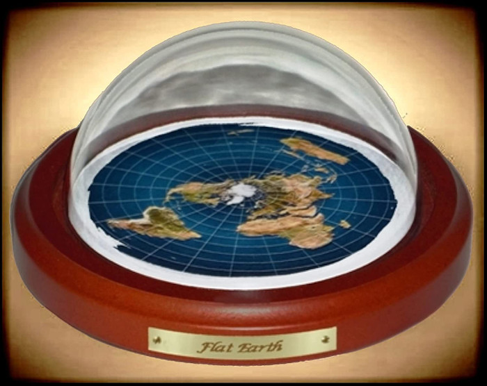
It turns out that you can buy a physical model of a flat Earth, just like you can buy a globe of the spherical Earth. Some of them, honestly,
Here’s one from Flat Earth Merchandise, which is actually available on Amazon (only $24.95). It’s got a nice wooden base, with the standard, distorted flat Earth map occupying the center. It also features a clear dome that fits over the map.
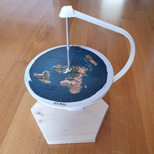
Another much more interesting model is provided by an Italian company
Well, the map itself isn’t all that interesting — it’s the same standard polar projection. However, they’ve created a model where the flat Earth map can be rotated around a central axel,
Is There a Better Map Representation?
All projections of a spherical globe onto a two-dimensional representation contain some amount of distortion, either in shape, area, distances between elements, or directional relationships between elements. I’ve criticized the standard polar projection for essentially exhibiting all of these effects to varying degrees.
Since some distortion is inevitable, choosing a map representation requires compromise. What’s important to you? What are you trying to illustrate with your map?
Given that choices have to be made, I choose to minimize distortion in shape and area, sacrificing the other attributes of the map. Is there a projection that accomplishes this?
Yes, as a matter of fact. In 1943, Buckminster Fuller created the Dymaxion Map. This map projects a sphere onto a (mostly) regular icosahedron. For those who aren’t familiar with an icosahedron, it’s a twenty-sided shape where each face is a triangle. If you’ve played D&D, you may have rolled that twenty-sided die—that’s a regular icosahedron.
After projection, the icosahedron is “unfolded” in a very specific fashion, showing all continents in their proper size and shape with minimal distortion. Close connections between continents are also preserved, though distances and directions are not.
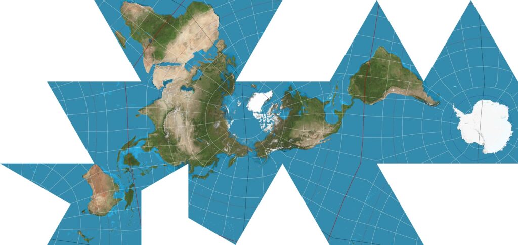
This is a map we can work with in building our futuristic flat world. In the next installment, we’ll take a harder look at the scientific aspects of this worldbuilding project, including: gravity, day cycles, climate, weather, etc.
If this kind of worldbuilding project appeals to you, check out Daedalus, my last world building project. In that effort, I explored the worldbuilding for a vast slower-than-light (STL) colony ship with multiple large-scale habitats.
Leave a Reply